sexta-feira, março 19, 2010

CUAUHTÉMOC, MÉXICO

Photobucket


País: México.
Año singladura: 1982.
Eslora: 90,50 metros.
Manga: 12 metros.
Calado: 5,40 metros.
Altura total: 47 metros
Tripulación: 218 hombres
Superficie vélica: 2.368 m2

IMO Number:8107505
MMSI Number: 345186001
Callsign: XCBF


Este velero construido en los astilleros Celaya (Bilbao), a principios de 1981, tiene el mérito de haber navegado ininterrumpidamente a vela 1.342,7 millas náuticas en 124 horas, a una velocidad promedio de 10.83 nudos, estableciendo un récord dificilmente superable.


Photo & Copyright Amarre.com / Escuela Nautica / Buques escuela

quinta-feira, março 18, 2010

HABITAT SUBAQUÁTICO

Photobucket

Photo & Copyright Kim

quarta-feira, março 17, 2010

NO INTERIOR DO NAVIO

Photobucket

Photo & Copyright Andrea

terça-feira, março 16, 2010

PHARE DU CAP LEUCATE, AUDE, FRANCE

Photobucket


Coordinates 42°54′5″N 003°03′3″E / 42.90139°N 3.05083°E / 42.90139; 3.05083
Year first constructed: 1950
Year first lit: 1951
Automated: ?
Height: 19.4 m
Focal Height: 68.3 m
Intensity: 180 W
Range: 20 nautical miles (37.0400000000000 km)
Characteristic: white cycle every 10 seconds


Photo & Copyright Wikipédia

segunda-feira, março 15, 2010

FARO ISULA DI CAPRI, ITALY

Photobucket


Tower: Hexagonal stone tower on stone building
Height: 28 m
Light: Height: 74 m
Range: 25 Nautical Miles
Characteristic: Fl W 5 sec
Optic: Current: Nav Original:?? Fresnel
Fog Signal: Current: None Original: None


Photo & Copyright John Armascot

domingo, março 14, 2010

CAPE PEMBROKE LIGHTHOUSE, FALKLAND ISLANDS

Photobucket


The two main islands of the Falkland Islands lie about 300 miles off the coast of Argentina in the South Atlantic. A British settlement was first established on the islands in 1765. More recently, the Falklands have been best known to the rest of the world for a brief 1982 war, when Argentine forces battled Great Britain over issues of sovereignty. One of the casualties of that war was the Cape Pembroke Lighthouse, located at the most easterly point of the Falklands, about seven miles east of the capital city of Stanley. Damaged during the conflict and eventually replaced by an automatic modern light structure nearby, the decommissioned lighthouse is now being restored.

The hazardous approach to the important harbor at Stanley led to the establishment of a red and white wooden daymark at Cape Pembroke in the 1840s. In 1854, this gave way to a 60-foot cast iron lighthouse that was pre-fabricated in London. The lighthouse, operated by Britain’s Trinity House, was painted with red and white bands. In 1889, it was changed to all white.

A telephone line was laid from the lighthouse to Stanley in 1897, an event later commemorated on a postage stamp. It was the first line laid by the government of the Falklands.

By the early 1900s, the foundation of the lighthouse had deteriorated to the point that it was considered unsafe, so the tower was moved onto a new foundation in 1906. The lantern was also replaced at this time. The work was carried out by a local crew supervised by a Trinity House official and four contractors from Britain. The lighthouse, about 200 yards west of its old position, went into service in June 1907.

One of the most dramatic episodes in the lighthouse’s history involved the wreck of the British full-rigged ship Criccieth Castle. In the spring of 1912 the ship had picked up a cargo of 2,800 tons of guano at Ballistas off the coast of Peru. As the vessel tried to round Cape Horn through a ferocious storm, high seas broke off its rudder and caused a massive leak. The crew and passengers managed to escape in two lifeboats.

One of the boats, carrying seven crew members, was never seen again. The other lifeboat carried the captain, his wife and four year-old son, along with 14 other crew members. The captain decided to attempt to reach the Falklands 180 miles away, and after six days battling frostbite and thirst the survivors made it to Cape Pembroke. Six crew members had died.

The lighthouse keepers waded out and pulled the boat ashore. The passengers took refuge in the keeper’s house, where they were provided a fire to warm themselves and hot food and drink. A doctor had to cut the frozen clothes from the survivors’ bodies. Two more crew members died as a result of the ordeal, and the lifeboat from the Criccieth Castle was preserved as a memorial in Stanley.

The lighthouse operated without interruption until the Argentine invasion of 1982. Reginald Silvey, keeper at the time of the invasion, aided British forces by broadcasting reports on Argentinean troop movements using an illegal-held radio. Frustrated Argentineans searched in vain for the source of the signals. According to an article in the UK newspaper The Guardian, Keeper Silvey “continued to be a thorn in the side of the Argentineans . . . until the very end of the war.”

The lighthouse has been gradually restored over the past decade. It stands as a symbolic beacon for tourists as the Falklands are becoming a popular vacation destination. Cape Pembroke is a prime birdwatching area for those wishing to view penguins and a variety of seabirds.

When the restoration is complete, there are plans to install an exhibit of lighthouse history. In the meantime, interested persons can arrange for access by contacting the Falkland Islands Museum and National Trust.


Photo & Copyright Lighthouse Digest

sábado, março 13, 2010

GODREVY ISLAND AND THE LIGHTHOUSE, ENGLAND

Photobucket


Godrevy Island is a small, rocky isle situated off the northern Cornish coast, near St. Ives. Godrevy Island is part of the Portreath Heritage Coast. The picturesque little island is dominated by a famous lighthouse, which was immortalised in the classic Virginia Woolf novel To the Lighthouse (the novelist got her inspiration for the story from a visit to Godrevy Island). Virginia Woolf is not the first person or indeed the first writer to be influenced and inspired by the peaceful beauty of Godrevy.

Preperation for the building of the lighthouse began in 1857. For many years cargo ships had been wrecked on the treacherous rocks and reefs along the Godrevy coast area. When a massive steamer called 'The Nile' was wrecked with the loss of all hands in 1854, the public began crying out for a lighthouse to be built at Godrevy. The permit for the lighthouse construction was passed in 1857, and local workmen worked throughout 1858 to complete the vital lighthouse.

The Godrevy light shone for the first time on March 1st 1859. Three keepers were assigned to the lighthouse- two would stay on the island, and one would stay on the mainland. The lighthouse proved its worth, functioning well for many years. Shortly before 1900 a telephone link was installed between Godrevy Island and the mainland.


Photo & Copyrighr Angelfire.com

sexta-feira, março 12, 2010

FAROL DAS BERLENGAS

Photobucket


Edição Oficinas do "Comércio do Porto"

quinta-feira, março 11, 2010

USS NIMITZ CVN-68

Photobucket

Photobucket


Keel Laid: June 22, 1968
Launched: May 13, 1972
Commissioned: May 3, 1975
Builder: Newport News Shipbuilding Co., Newport News, Va.
Propulsion system: two nuclear reactors
Main Engines: four
Propellers: four
Blades on each Propeller: five
Aircraft elevators: four
Catapults: four
Arresting gear cables: four
Lengths, overall: 1.092 feet (332.85 meters)
Flight Deck Width: 252 feet (76.8 meters)
Area of flight deck: about 4.5 acres (18211.5 m2)
Beam: 134 feet (40.84 meters)
Draft: 37.7 feet (11.3 meters)
Displacement: approx. 97,000 tons full load
Speed: 30+ knots
Planes: approx. 85
Crew: Ship: 3,200 ; Air Wing: 2,480
Armament: two Mk 29 NATO Sea Sparrow launchers, two SeaRAM Systems
Homeport: San Diego, Calif.


Photo & Copyright Navy Site, United States Navy

quarta-feira, março 10, 2010

NAVEGAR É PRECISO

Photobucket


photo & Copyright Erez

terça-feira, março 09, 2010

LITORAL

Photobucket


Photo & Copyright David A

segunda-feira, março 08, 2010

AMERIGO VESPUCCI, ITALIA

Photobucket

Nella seconda metà degli anni Venti la Marina Militare Italiana affrontò il problema di rinnovare le Unità destinate all'addestramento degli Allievi dell'Accademia Navale. Lo Stato Maggiore ritenne che, nonostante lo sviluppo della nuova flotta fosse orientato verso una tecnologia sempre più avanzata, il "miglior" impatto con l'ambiente marino e la sua conoscenza fosse quello che si poteva apprezzare stando a bordo di una nave a vela, che del mare e del vento subisce maggiormente i condizionamenti e che degli elementi naturali richiede quindi la più vasta conoscenza. Del resto, già dal 1893 l'attività in mare per gli Allievi dell'Accademia Navale veniva effettuata a bordo di una nave a vela, che portava anch'essa il nome di Amerigo Vespucci, un ex-incrociatore entrato in servizio nel febbraio del 1885 come Nave di 1ª linea, poi adattato a Nave Scuola.

Nel 1925 quindi, approssimandosi la fine della vita operativa del primo Amerigo Vespucci, per iniziativa dell'Ammiraglio Giuseppe Sirianni, Ministro della Marina, fu decisa la costruzione di due Navi Scuola, affidandone il progetto al Tenente Colonnello del Genio Navale Francesco Rotundi, il quale, nel disegnarne le forme, si ispirò a quelle di un vascello della fine del Settecento/inizi Ottocento.

La prima delle due Unità, il Cristoforo Colombo, entrò in servizio nel 1928 e fu impiegata come Nave Scuola fino al 1943; dopo la fine della Seconda Guerra Mondiale fu ceduta all'Unione Sovietica in conto risarcimento danni di guerra. L'Amerigo Vespucci, invece, fu impostata il 12 maggio 1930 nel Regio Cantiere Navale di Castellamare di Stabia, fu varata il 22 febbraio 1931 ed entrò in servizio a luglio dello stesso anno. Il 4 luglio 1931, al comando del Capitano di Vascello Augusto Radicati di Marmorito, nobile piemontese (che, con il grado di Capitano di Fregata, era stato l'ultimo Comandante del precedente Amerigo Vespucci), partì per la sua prima Campagna Addestrativa in Nord Europa.

IMO Number: 8310645
MMSI Number: 253093000
Callsigh: LXSS

Photo & Copyright Republica Italiana, Ministero Della Defesa, Marina Militare

domingo, março 07, 2010

MUKILTEO LIGHTHOUSE, USA

Photobucket

The Mukilteo Historical Society is committed to preserving the Mukilteo Light Station and the history of Mukilteo. The Mukilteo Historical Society assists the U.S. Coast Guard and the City of Mukilteo in the preservation, maintenance and accessibility of the light station for all to enjoy.

The Mukilteo Light Station continues to play an important navigational role with its Fourth Order Fresnel lens that has a range of 12 nautical miles. In addition to the beautifully landscaped grounds and stunning works of architecture, visitors are drawn to its romantic, scenic, educational, and historical values.


Photo & Copyright Mukilteo Historical Society

sábado, março 06, 2010

USS ENTERPRISE CVN-65

Photobucket

USS Enterprise (CVN 65), the world's first nuclear-powered aircraft carrier, commemorates a name which has been a continuing symbol of the great struggle to retain American liberty, justice and freedom since the first days of the American Revolutionary War. She is the eighth ship of the Fleet to carry this illustrious name that is literally defined as boldness, energy, and invention in practical affairs.

The ships named Enterprise have fought in some of the greatest naval battles in the history of the United States. These ships were manned by Sailors committed to victory under the harshest of conditions.

The Sailors onboard Enterprise are part of that proud tradition and heritage of the men and women who have gone before them and live up to their legacy with honor, courage and commitment.


Photo & Copyright USS Enterprise, official U.S. Navy website

sexta-feira, março 05, 2010

POINT FERMIN LIGHTHOUSE, CALIFORNIA, USA

Photobucket

Built in 1874, the Point Fermin Lighthouse was the first navigational light into the San Pedro Bay. Phineas Banning, with the support of many local businessmen, petitioned the Federal Government and the US lighthouse Board to place a lighthouse on the point in 1854. Although the Lighthouse Board agreed funding and land disputes delayed its construction until 1874.


Photo & Copyright Point Fermin Lighthouse Historic Site and Museum

quinta-feira, março 04, 2010

CAP DES ROSIERS LIGHTHOUSE, CANADA

Photobucket


Photo & Copyright Lighthouse Depot

quarta-feira, março 03, 2010

STAVROS S NIARCHOS

Photobucket

The Tall Ships Youth Trust owns a magnificent 60 metre square-rigged ship, four 22 metre Challenger Yachts - the Challenger Fleet and a 19 metre Catamaran - Tall Ships Cat. The Fleet is operated by Tall Ships Ltd., one of the charity's subsidiaries, and works 12 months of the year both around the UK and abroad, offering Adventure Sailing Voyages.

There is no finer sight than a fully rigged square ship and the Trust's ship, Stavros S Niarchos is one of the world's most magnificent brigs.


IMO Number: 9222314
MMSI Number: 232007330
Calsign: MZIU7


Photo & Copyright Tall Ships Adventures, Suporting The Tall Ships you Trust

terça-feira, março 02, 2010

POINT CABRILLO LIGHTHOUSE, CALIFORNIA, USA

Photobucket


Although Point Cabrillo was surveyed by the U. S. Lighthouse Service in 1873, construction of the Light Station didn't begin until after the 1906 earthquake. The demand for lumber to rebuild San Francisco meant that maritime commerce on the north coast was at an all time high and a Lighthouse was critical to the safety of the ships and their valuable cargo. Construction of the Light Station began in 1908, and the lens was illuminated for the first time on June 10,1909, under head keeper Wilhelm Baumgartner.


Photo & Copyright Point Cabrillo Lighkeepers Association

segunda-feira, março 01, 2010

LIGHTHOUSE SANTACRUZ, CALIFORNIA, USA

Photobucket

Lighthouse construction virtually came to a halt during the Civil War, but efforts to procure a lighthouse for Santa Cruz were restarted in 1865. Congress allotted $10,000 for the lighthouse on March 2, 1867, and in April of 1868, a ruling by the California Supreme Court brought to an end the long-standing dispute over the property. The following month, ten acres on Point Santa Cruz were purchased from the now lawful owner for $2,400 in gold coin.

The construction plans used for the original Ediz Hook Lighthouse in Washington were recycled at Santa Cruz. The lighthouse was to be just that – a one-and-a-half story house with a pitched roof surmounted by a square light tower. Work on the wooden structure, which would rest on a brick foundation, began in the summer of 1869 and was completed in just a couple of months. Meanwhile, the octagonal lantern room was fabricated at the lighthouse depot on New York’s Staten Island and then shipped to California. A fifth-order Fresnel lens and a lard-oil lamp were installed in the lantern room after its delayed arrival, and the lighthouse was ready for its first lighting on January 1, 1870. The Santa Cruz Lighthouse entered service as the twelfth beacon along the California coast.


Photo & Copyright Lighthousesfriends.com

domingo, fevereiro 28, 2010

TOUS LES BATEAUX DU MONDE

Photobucket


La fabuleuse collection de l'amiral Pâris
Exposition
[mercredi 10 mars 2010 - dimanche 19 septembre 2010]
Paris, palais de Chaillot


Le musée national de la Marine présente une exposition-événement, un voyage au cœur des cultures maritimes du monde, à travers une impressionnante collection de maquettes de bateaux, trésors de ses collections.


Musée National de la Marine
Palais de Chaillot
17 place du Trocadéro
75116 PARIS

sábado, fevereiro 27, 2010

DESCOBERTA ILHA DE LIXO NO ATLANTICO

Photobucket


Uma pesquisa apresentada na conferência Ocean Sciences Meeting, realizada em Portland, nos EUA, descobriu uma ‘ilha’ de lixo plástico em pleno oceano Atlântico.


Kara Lavender, coordenadora da investigação levada a cabo pela Sea Education Association, organização americana que investiga os oceanos, disse à ‘BBC News’ que durante mais de 20 anos os investigadores analisaram aquela região do oceano e recolheram dados num total de 6100 amostras com redes puxadas, junto às Caraíbas e ao largo da costa leste norte-americana.

Lavender explicou que a sua equipa verificou que nesta região do oceano, entre os 22 e os 38 graus norte, os plásticos ficam ali concentrados por largas temporadas, não sendo ainda conhecidos os impactos que tal facto tem na vida marítima.

A investigadora, que comparou a ilha de lixo do Atlântico à do Pacífico, sublinhou que esta é uma questão que tem sido “muito ignorada” pelos responsáveis.


Photo Poluição devida ao derrame do Superpetroleiro Exxon Valdez
Texto de Patricia M. Carvalho, Jornal Correio da Manha


sexta-feira, fevereiro 26, 2010

FAROL FANTASMA

Photobucket


Photo & Copyright Alper

quinta-feira, fevereiro 25, 2010

MONUMENTO AOS DESCOBRIMENTOS, LISBOA, PORTUGAL

Photobucket


O Monumento-Padrão dos Descobrimentos foi o ex-libris da Exposição do Mundo Português, realizada em Lisboa no ano de 1940.
Esta mostra comemorava o oitavo centenário sobre a data em que D. Afonso Henriques ostentara, pela primeira vez, o título de rei de Portugal, bem assim como o tricentenário da Restauração da independência de 1640.

O evento materializou-se em Belém, na Praça do Império, revelando-se um grande acontecimento político e artístico do Estado Novo.
O Monumento-Padrão dos Descobrimentos foi planeado pelo arquitecto Cottinelli Telmo e esculpido por Leopoldo de Almeida.
Em 1940, o monumento fora erguido numa estrutura provisória, sendo passado à pedra, com estrutura de betão, definitivamente em 1960, altura em que se assinalava o V Centenário da morte do infante D. Henrique.
Esta obra de arquitectura e escultura foi criada com a intenção de consagrar os Descobrimentos Portugueses, aventura iniciada no século XV.

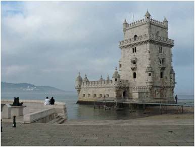
O monumental Padrão dos Descobrimentos atinge uma altura de 50 metros, com uma largura de 20 por um comprimento máximo de 46 metros.
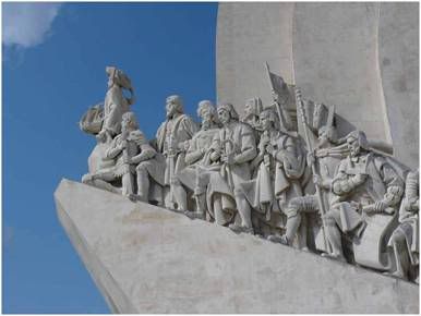
A maior figura esculpida é a do infante D. Henrique, que possui 9 metros de altura, enquanto o restante grupo de 32 ilustres imagens atinge os 7 metros de altura. No seu interior, um elevador conduz a um panorâmico miradouro situado no topo do monumento.

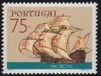
O padrão encontra-se edificado na margem do Rio Tejo, implantado num pequeno terreiro em calçada portuguesa, decorado por uma rosa-dos-ventos e um planisfério em mármore rosa, onde se assinalam, com o desenho de naus e caravelas, as principais rotas e datas dos Descobrimentos Portugueses. O delineador do projecto foi o arquitecto Cristino da Silva.

Arquitectonicamente, o Padrão dos Descobrimentos configura-se simbolicamente como uma caravela, com a verticalidade da sua parede simulando as velas, encimada pelas armas portuguesas da época. A porta de acesso ao monumento é preenchida pela enorme escultura de uma espada, decorada no punho com a cruz da Ordem de Avis - simbolizando a força das armas e da fé cristã.

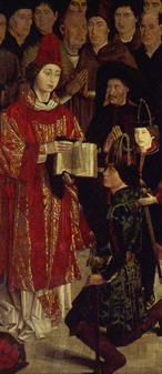
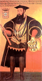
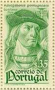
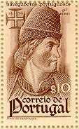
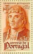
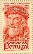
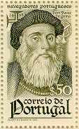
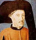
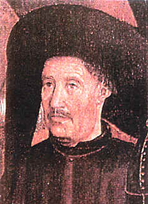
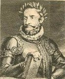
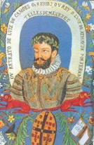
Na proa da caravela de pedra destaca-se a figura tutelar do infante D. Henrique, olhando o horizonte e segurando entre as mãos a caravela portuguesa. As rampas laterais são preenchidas, anacronicamente, por uma corrente de 32 figuras marcantes da história portuguesa dos séculos XV e XVI (16 em cada um dos lados), personagens ligadas, directa ou indirectamente, à empresa dos Descobrimentos. Assim, governantes, marinheiros, cartógrafos, poetas, artistas e cronistas, guerreiros ou evangelizadores, foram esculpidos com rigor e robustez. Entre os demais, destacam-se as representações do infante D. Pedro, de D. Afonso V, Vasco da Gama, Pedro Álvares Cabral, Fernão de Magalhães, Diogo Cão, Pedro Nunes, Luís de Camões, Nuno Gonçalves, Fernão Mendes Pinto, João de Barros e Afonso de Albuquerque.

Renovado e adaptado na década de 80, o interior do Monumento aos Descobrimentos revela-se como um espaço polivalente de fruição cultural, proporcionado pelo seu auditório e pelas salas de exposição adjacentes.


Photo Anónimo
Texto Infopédia

quarta-feira, fevereiro 24, 2010

VAGA TOCADA A VENTO

Photobucket


Photo & Copyright Vlaho

terça-feira, fevereiro 23, 2010

TORRE DE BELÉM, LISBOA, PORTUGAL

Photobucket


Inicialmente foi uma fortaleza militar imponente e emblema de prestígio real. É possível verificar em toda a edificação a grandiosidade do tempo em que Portugal era o país pioneiro na Aventura Marítima.

A epopeia dos Descobrimentos trouxe ao Mundo diferentes e inovadoras perspectivas de relacionamento entre gentes e nações, através de um melhor conhecimento do Homem, do Planeta e das consequentes relações à escala mundial.

Lisboa era no momento uma cidade culturalmente multifacetada, dirigida e vocacionada para o mar e as trocas comerciais, representando na época o culminar de um processo histórico que, envolvendo raças e povos distintos, vem dar lugar a essa individualidade e especificidade tão notoriamente portuguesas.

Situada a alguns quilómetros do centro de Lisboa, a Torre de Belém foi construída no local onde o rio se alarga para o estuário, e a sua estrutura assente sobre um afloramento de basalto, rocha resistente e impermeável.

Destinada a proteger a cidade de Lisboa, que era uma das mais ricas e cosmopolitas do Mundo de então, e a Barra do Tejo, que ao tempo desfrutava de uma intensa actividade por via do importante comércio marítimo, foi também utilizada como prisão, cárcere político dos que se opuseram à ocupação espanhola.

Construída no reinado de D. Manuel I, faz parte integrante de um plano idealizado e estudado ao tempo de D. João II.

De facto criou-se um sistema integrado e tripartido de defesa marítima, que consistia na construção de três fortalezas:
uma na baía de Cascais;
na Caparica, a de São Sebastião ou, como habitualmente é designada, Torre Velha;
na margem direita, a Fortaleza do Restelo, mais tarde conhecida por Torre de Belém devido à praia do mesmo nome.
As três fortalezas eram complementadas pelo cruzamento de fogo de pequenas caravelas artilhadas com peças de calibre apreciável e que executavam tiro de ricochete, técnica inédita até à altura, tal como o que então se passa com o advento da artilharia pirobalística, em que a estratégia e táctica militares sofrem profundas alterações e modificações que vão revolucionar os conceitos da arquitectura militar.

A forma arquitectónica da Torre foi influenciada pelo surgir desta nova artilharia que requeria muralhas mais fortes e sugeria o desenvolvimento de um baluarte poligonal.

D. Manuel I continuou o plano defensivo iniciado pelo seu antecessor, mandando erguer a Torre de São Vicente a par da de Belém, cujo nome é uma homenagem ao patrono de Lisboa, continuando-se o plano de defesa com o seu sucessor D. João III e a edificação de uma fortaleza em São Julião da Barra.


Photo Anónimo
Texto WMFPORTUGAL

segunda-feira, fevereiro 22, 2010

PESCA GELADA

Photobucket


Photo & Copyright Jason

domingo, fevereiro 21, 2010

NAVIO COM HISTÓRIA

Photobucket


Photo & Copyright Harald

sábado, fevereiro 20, 2010

NAUFRÁGIO DO CONCORDIA

Photobucket


Um veleiro canadiano naufragou quinta-feira ao largo do Rio de Janeiro, mas os 64 passageiros, todos estudantes e membros da tripulação foram salvos, disse ontem à agência France Presse um porta voz da Armada brasileira.

O navio-escola 'Concordia' naufragou às 17h00 locais (19h00 na Madeira) a 300 milhas (550 quilómetros) da costa brasileira, num momento em que enfrentava fortes ventos, descreveu o comandante Romualdo, por telefone a partir de Brasília.
O veleiro, propriedade da universidade canadiana West Island College International, "emitiu sinais de socorro, recebidos pela Marinha, que enviou aviões de reconhecimento", informou. Segundo o comandante Romualdo, "os aviões constataram que havia pessoas dentro das embarcações salva vidas e o socorro foi enviado".
Os 64 estudantes, professores e e membros da tripulação "estão todos em segurança" e encontram-se bem de saúde, disse ainda o porta-voz, que não referiu o número total de pessoas a bordo. O 'Concordia' partiu a 8 de Fevereiro do Recife e tinha como destino Montevideu, capital do Uruguai.

IMO Number: 1001269
MMSI Number: 314178000
Callsign: 8PRN


Photo Texto & Copyright Portal Net Madeira

sexta-feira, fevereiro 19, 2010

CUTTY SARK

Photobucket


Cutty Sark has travelled across the world, sailing under both the Red Ensign and the Portuguese flag, visiting every major port in the world through the course of her working life. In admiration of her beauty and in recognition of her fame, she was preserved for the nation by Captain Wilfred Dowman in 1922.

Since then, the old clipper has been berthed in Falmouth and Greenhithe, finally arriving at her current resting place in Greenwich in 1954.

To learn more about her eventful past, or to explore the museum collections which give an insight to the many stories the ship has to tell, select from the menu on the left

IMO Number: 5086279
MMSI Number: 219500000
Calsign: OXDK

Photo & Copyright Cutty Sark, The World's Last Tea Clipper

quinta-feira, fevereiro 18, 2010

BARCO ABANDONADO ..

Photobucket


A minha vida é um barco abandonado
Infiel, no ermo porto, ao seu destino.
Por que não ergue ferro e segue o atino
De navegar, casado com o seu fado?

Ah! falta quem o lance ao mar, e alado
Torne seu vulto em velas; peregrino
Frescor de afastamento, no divino
Amplexo da manhã, puro e salgado.

Morto corpo da ação sem vontade
Que o viva, vulto estéril de viver,
Boiando à tona inútil da saudade.

Os limos esverdeiam tua quilha,
O vento embala-te sem te mover,
E é para além do mar a ansiada Ilha.


Photo & Copyright Adrian
Poema Fernando Pessoa "In Cacioneiro"
"A Minha Vida é um Barco Abandonado"

segunda-feira, fevereiro 08, 2010

FAROL DA PRAIA DA BARRA E SALINAS, AVEIRO IV

Photobucket


Postal do Centro de Caridade Nossa Senhora Perpétuo Socorro, Porto

domingo, fevereiro 07, 2010

FAROL DA PRAIA DA BARRA, AVEIRO III

Photobucket


Postal do Centro de Caridade Nossa Senhora Perpétuo Socorro, Porto

sábado, fevereiro 06, 2010

sexta-feira, fevereiro 05, 2010

quinta-feira, fevereiro 04, 2010

quarta-feira, fevereiro 03, 2010

FAROL DO FORTE DA BARRA, AVEIRO III

Photobucket


Postal Portugal Turistico

terça-feira, fevereiro 02, 2010

FAROL DO FORTE DA BARRA, AVEIRO II

Photobucket


Postal Edição da EDERAV

segunda-feira, fevereiro 01, 2010

FAROL DO FORTE DA BARRA, AVEIRO I

Photobucket


Postal Edição da Papelaria Avenida

sexta-feira, janeiro 22, 2010

PESCADORES DAS FILIPINAS

Photobucket


Photo & Copyright James

quarta-feira, janeiro 20, 2010

NAS ILHAS GALÁPAGOS

Photobucket


Photo & Copyright Heiko

terça-feira, janeiro 19, 2010

NAVIO ESCOLA SAGRES INICIA HOJE A 3ª VIAGEM DE CIRCUM-NAVEGAÇÃO

Photobucket


O Navio-Escola Sagres largou, no passado dia 19 de Janeiro, de Lisboa rumo a uma viagem de Volta ao Mundo, com duração de cerca de 11 meses. Esta é a terceira vez que a Sagres realiza uma Circum-navegação, tendo as últimas viagens ocorrido em 1978/ 79 e em 1983/84.

Durante esta viagem a Sagres irá visitar vários países, são eles o Brasil, o Uruguai, a Argentina, o Chile, o Peru, o Equador, o México, os EUA, o Japão, a China (incluindo Macau), a Coreia do Sul, a Indonésia, Timor-Leste, Singapura, a Tailândia, a Malásia, a União Indiana, o Egipto e a Argélia.

Nesta viagem a Sagres terá como missão a formação dos cadetes da Escola Naval, promover a imagem de Portugal no Mundo, contactar os Portugueses na Diáspora e participará em vários eventos, entre os quais o Encontro e Regata Internacional de Grandes Veleiros - Velas Sudamérica 2010, as Comemorações do Dia de Portugal em S. Diego, as Cerimónias Comemorativas dos 150 anos do Tratado de Paz, Amizade e Comércio entre Portugal e o Japão e participará na EXPO Xangai 2010.

O Navio-Escola “Sagres” é um veleiro com 90 metros de comprimento, com 4 mastros e armação em barca, construída nos estaleiros navais Blohm & Voss, na Alemanha, em 1937 e navega há 48 anos com a missão principal de assegurar a formação marinheira dos futuros oficiais da Marinha Portuguesa, complementando as componentes técnica e académica ministradas na Escola Naval e a de representação da Marinha e do país no estrangeiro, desempenhando o papel de embaixada itinerante de Portugal.

A “Sagres” é comandada pelo Capitão-de-Fragata Luís Pedro Pinto Proença Mendes e contará para esta missão com uma guarnição de 182 militares, incluindo 35 Cadetes da Escola Naval durante três meses.

IMO Number: 0
MMSI Number: 263141000
Calsign: CTEC


Texto Nautica Press

sábado, janeiro 16, 2010

ABANDONED RUSSIAN POLAR NUCLEAR LIGHTHOUSES

Photobucket


Russian Northern coast is a vast territory lays for a few thousand of miles and all this coastline is inside the Polar Circle. Long polar winters mean no daylight at all, just one day changes another without any sign of the Sun rising above the horizon. There is only polar night for 100 day a year.

But across this Northern coast there was always a short way for the cargo boats to travel from Eastern part of Russia to the Western. Now this trip can be made fairly easy with the appearance of all the satellite navigation equipment like GPS and others, but during the Soviet Era they had none of this.

So, the Communist Party of the Soviet Union decided to build a chain of lighthouses to guide ships finding their way in the dark polar night across uninhabited shores of the Soviet Russian Empire. So it has been done and a series of such lighthouses has been erected.
They had to be fully autonomous, because they were situated hundreds and hundreds miles aways from any populated areas. After reviewing different ideas on how to make them work for a years without service and any external power supply, Soviet engineers decided to implement atomic energy to power up those structures.
So, special lightweight small atomic reactors were produced in limited series to be delivered to the Polar Circle lands and to be installed on the lighthouses. Those small reactors could work in the independent mode for years and didn’t require any human interference, so it was very handy in the situation like this.
It was a kind of robot-lighthouse which counted itself the time of the year and the length of the daylight, turned on its lights when it was needed and sent radio signals to near by ships to warn them on their journey. It all looks like ran out the sci-fi book pages, but so they were.

Then, after the collapse of the Soviet Union, the unattended automatic lighthouses did it job for some time, but after some time they collapsed too. Mostly as a result of the hunt for the metals like copper and other stuff which were performed by the looters.
They didn’t care or maybe even didn’t know the meaning of the “Radioactive Danger” sign and ignored them, breaking in and destroying the equipment. It sounds creepy but they broke into the reactors too causing all the structures to become radioactively polluted.

Those photos are from the trip to the one of such structures, the most close to the populated areas of the Russian far east. Now, there are signs “RADIOACTIVITY” written with big white letters on the approaching paths to the structure but they don’t stop the abandoned exotics lovers.


Photo & Copyright English Russia

domingo, janeiro 10, 2010

A SHIP IN A COOL WATERS

Photobucket


Photo & Copyright Frode

quarta-feira, janeiro 06, 2010

SINGLE SHIP

Photobucket


Photo & Copyright Frank

domingo, janeiro 03, 2010

POINT PINOS LIGHTHOUSE, MONTEREY, CALIFORNIA, USA

Photobucket


The oldest active lighthouse on the West Coast is located at the western edge of the town of Pacific Grove, near Monterey.
Pinos has shone since 1855, and the building, third-order lens and prisms of the light are all original

Foto & Copyright California lights

segunda-feira, dezembro 21, 2009

SURFISTA

Photobucket


Photo & Copyright Juan

quarta-feira, novembro 11, 2009

PESCADORES AO PÔR DO SOL

Photobucket


Photo & Copyright Blaize

sexta-feira, outubro 02, 2009

COMPETICION

Photobucket


Photo & Copyright Blaize

terça-feira, setembro 01, 2009

LIFE GUARD

Photobucket


Photo & Copyright Roger