quinta-feira, setembro 23, 2010

AGUAS ARDENTES

Photobucket

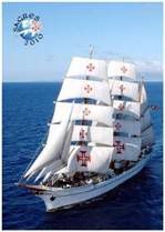
«E já que de tão longe navegais,
Buscando o Indo Idaspe e terra ardente,
Piloto aqui tereis, por quem sejais
Guiados pelas ondas sàbiamente.
Também será bem feito que tenhais
Da terra algum refresco, e que o Regente
Que esta terra governa, que vos veja
E do mais necessário vos proveja.»


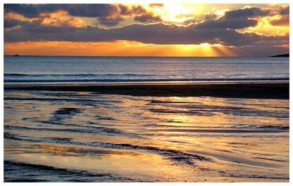
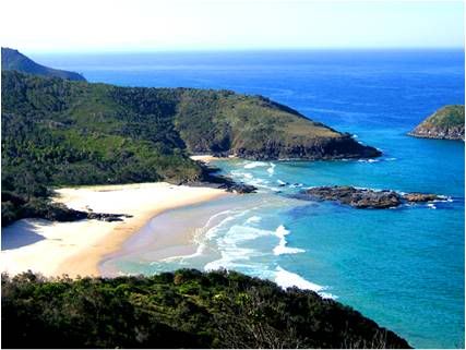
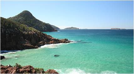
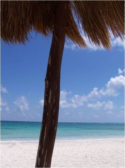
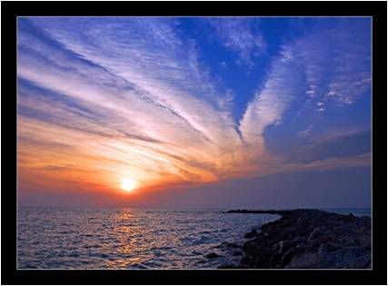
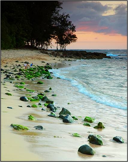
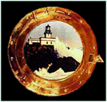
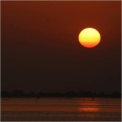
Photo & Copyright Daniel
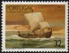
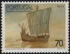
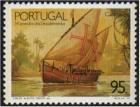
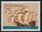
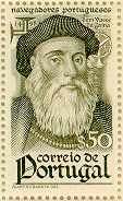
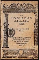
Poema Luis de Camoes, Os Lusiadas, Canto I, 55

quarta-feira, setembro 22, 2010

ENRROLAR DA ÁGUA

Photobucket

«Esta Ilha pequena, que habitamos,
É em toda esta terra certa escala
De todos os que as ondas navegamos,
De Quíloa, de Mombaça e de Sofala;
E, por ser necessária, procuramos,
Como próprios da terra, de habitá-la;
E por que tudo enfim vos notifique,
Chama-se a pequena Ilha – Moçambique.


Photo & Copyright Christen
Poema Luis de Camoes, Os Lusiadas, Canto I, 54

terça-feira, setembro 21, 2010

RUINAS

Photobucket

– «Somos (um dos das Ilhas lhe tornou)
Estrangeiros na terra, Lei e nação;
Que os próprios são aqueles que criou
A Natura, sem Lei e sem Razão.
Nós temos a Lei certa que ensinou
O claro descendente de Abraão,
Que agora tem do mundo o senhorio;
A mãe Hebreia teve e o pai, Gentio.


Photo & Copyright Christian
Poema Luis de Camoes, Os Lusiadas, Canto I, 53

segunda-feira, setembro 20, 2010

CALIFORNIA SUNRISE

Photobucket

«E, por mandado seu, buscando andamos
A terra Oriental que o Indo rega;
Por ele o mar remoto navegamos,
Que só dos feios focas se navega.
Mas já razão parece que saibamos
(Se entre vós a verdade não se nega),
Quem sois, que terra é esta que habitais,
Ou se tendes da Índia alguns sinais?»


Photo & Copyright Chandru
Poema Luis de Camoes, Os Lusiadas, Canto I, 52

domingo, setembro 19, 2010

VOLTOU

Photobucket

«Do mar temos corrido e navegado
Toda a parte do Antártico e Calisto,
Toda a costa Africana rodeado;
Diversos céus e terras temos visto;
Dum Rei potente somos, tão amado,
Tão querido de todos e benquisto,
Que não no largo mar, com leda fronte,
Mas no lago entraremos de Aqueronte.


Photo & Copyright Charlie
Poema Luis de Camoes, Os Lusiadas, Canto I, 51

sábado, setembro 18, 2010

DIA DE PESCA

Photobucket

Comendo alegremente, perguntavam,
Pela Arábica língua, donde vinham,
Quem eram, de que terra, que buscavam,
Ou que partes do mar corrido tinham?
Os fortes Lusitanos lhe tornavam
As discretas repostas que convinham:
– «Os Portugueses somos do Ocidente,
Imos buscando as terras do Oriente.


Photo & Copyright Chuck
Poema Luis de Camoes, Os Lusiadas, Canto I, 50

sexta-feira, setembro 17, 2010

TÁ NA BOLINA

Photobucket

Não eram ancorados, quando a gente
Estranha polas cordas já subia.
No gesto ledos vêm, e humanamente
O Capitão sublime os recebia.
As mesas manda pôr em continente;
Do licor que Lieu prantado havia
Enchem vasos de vidro; e do que deitam
Os de Fáeton queimados nada enjeitam.


Photo & Copyright Carole
Poema Luis de Camoes, Os Lusiadas, Canto I, 49

quinta-feira, setembro 16, 2010

JARDIM DA TARDE

Photobucket

Cos panos e cos braços acenavam
Às gentes Lusitanas, que esperassem;
Mas já as proas ligeiras se inclinavam,
Pera que junto às Ilhas amainassem.
A gente e marinheiros trabalhavam
Como se aqui os trabalhos s' acabassem:
Tomam velas, amaina-se a verga alta,
Da âncora o mar ferido em cima salta.


Photo & Copyright Chandru
Poema Luis de Camoes, Os Lusiadas, Canto I, 48

quarta-feira, setembro 15, 2010

PRAIA DO DESCANSO

Photobucket

De panos de algodão vinham vestidos,
De várias cores, brancos e listrados;
Uns trazem derredor de si cingidos,
Outros em modo airoso sobraçados;
Das cintas pêra cima vêm despidos;
Por armas têm adagas e tarçados;
Com toucas na cabeça; e, navegando,
Anafis sonorosos vão tocando.

Photo & Copyright Chris
Poema Luis de Camoes, Os Lusiadas, Canto I, 47

terça-feira, setembro 14, 2010

AMARELO DA TARDE

Photobucket

As embarcações eram na maneira
Mui veloces, estreitas e compridas;
As velas com que vêm eram de esteira,
Dũas folhas de palma, bem tecidas;
A gente da cor era verdadeira
Que Fáëton, nas terras acendidas,
Ao mundo deu, de ousado e não prudente
(O Pado o sabe e Lampetusa o sente).

Photo & Copyright Brian
Poema Luis de Camoes, Os Lusiadas, Canto I, 46

segunda-feira, setembro 13, 2010

PRAIA DO PARAISO AZUL

Photobucket

Eis aparecem logo em companhia
Uns pequenos batéis, que vêm daquela
Que mais chegada à terra parecia,
Cortando o longo mar com larga vela.
A gente se alvoroça e, de alegria,
Não sabe mais que olhar a causa dela.
– «Que gente será esta? » (em si diziam)
«Que costumes, que Lei, que Rei teriam?»


Photo & Copyright Brett
Poema Luis de Camoes, Os Lusiadas, Canto I, 45

domingo, setembro 12, 2010

PRAIA DA AUSTRALIA

Photobucket

Vasco da Gama, o forte Capitão,
Que a tamanhas empresas se oferece,
De soberbo e de altivo coração,
A quem Fortuna sempre favorece,
Pêra se aqui deter não vê razão,
Que inabitada a terra lhe parece.
Por diante passar determinava,
Mas não lhe sucedeu como cuidava.


Photo & Copyright Brent
Poema Luis de Camoes, Os Lusiadas, Canto I, 44

sábado, setembro 11, 2010

O INFINITO EM AZUL

Photobucket

Tão brandamente os ventos os levavam
Como quem o Céu tinha por amigo;
Sereno o ar e os tempos se mostravam,
Sem nuvens, sem receio de perigo.
O promontório Prasso já passavam
Na costa de Etiópia, nome antigo,
Quando o mar, descobrindo, lhe mostrava
Novas ilhas, que em torno cerca e lava.


Photo & Copyright Brent
Poema Luis de Camoes, Os Lusiadas, Canto I, 43

sexta-feira, setembro 10, 2010

HORIZONTAL VISUAL NO FINAL DE TARDE

Photobucket

Enquanto isto se passa na fermosa
Casa etérea do Olimpo omnipotente,
Cortava o mar a gente belicosa
Já lá da banda do Austro e do Oriente,
Entre a costa Etiópica e a famosa
Ilha de São Lourenço; e o Sol ardente
Queimava então os Deuses que Tifeu
Co temor grande em pexes converteu.


Photo & Copyright Bob
Poema Luis de Camoes, Os Lusiadas, Canto I, 42

quinta-feira, setembro 09, 2010

SOMBRA SECA

Photobucket

Como isto disse, o Padre poderoso,
A cabeça inclinando, consentiu
No que disse Mavorte valeroso
E néctar sobre todos esparziu.
Pelo caminho Lácteo glorioso
Logo cada um dos Deuses se partiu,
Fazendo seus reais acatamentos,
Pera os determinados apousentos.


Photo & Copyright Ben
Poema Luis de Camoes, Os Lusiadas, Canto I, 41

quarta-feira, setembro 08, 2010

PRAIA NO EGIPTO

Photobucket

E disse assi: – «Ó Padre, a cujo império
Tudo aquilo obedece que criaste:
Se esta gente que busca outro Hemisfério,
Cuja valia e obras tanto amaste,
Não queres que padeçam vitupério,
Como há já tanto tempo que ordenaste,
Não ouças mais, pois és juiz direito,
Razões de quem parece que é suspeito.


Photo & Copyright Agata
Poema Luis de Camoes, Os Lusiadas, Canto I, 38

terça-feira, setembro 07, 2010

PESCA AO FINAL DO DIA

Photobucket

«E tu, Padre de grande fortaleza,
Da determinação que tens tomada
Não tornes por detrás, pois é fraqueza
Desistir-se da cousa começada.
Mercúrio, pois excede em ligeireza
Ao vento leve e à seta bem talhada,
Lhe vá mostrar a terra onde se informe
Da Índia, e onde a gente se reforme.»


Photo & Copyright Armagan
Poema Luis de Camoes, Os Lusiadas, Canto I, 40

segunda-feira, setembro 06, 2010

A PAISAGEM DO DESCANSO

Photobucket

«Que, se aqui a razão se não mostrasse
Vencida do temor demasiado,
Bem fora que aqui Baco os sustentasse,
Pois que de Luso vêm, seu tão privado;
Mas esta tenção sua agora passe,
Porque enfim vem de estâmago danado;
Que nunca tirará alheia enveja
O bem que outrem merece e o Céu deseja.


Photo & Copyright Anonymus
Poema Luis de Camoes, Os Lusiadas, Canto I, 39

domingo, setembro 05, 2010

MALIBU

Photobucket

A viseira do elmo de diamante
Alevantando um pouco, mui seguro,
Por dar seu parecer se pôs diante
De Júpiter, armado, forte e duro;
E dando ũa pancada penetrante
Co conto do bastão no sólio puro,
O Céu tremeu, e Apolo, de torvado,
Um pouco a luz perdeu, como enfiado;


Photo & Copyright Chandru
Poema Luis de Camoes, Os Lusiadas, Canto I, 37

sábado, setembro 04, 2010

ÁGUAS TROPICAIS

Photobucket

Mas Marte, que da Deusa sustentava
Entre todos as partes em porfia,
Ou porque o amor antigo o obrigava,
Ou porque a gente forte o merecia,
De antre os Deuses em pé se levantava:
Merencório no gesto parecia;
O forte escudo, ao colo pendurado,
Deitando pera trás, medonho e irado;


Photo & Copyright Cengiz
Poema Luis de Camoes, Os Lusiadas, Canto I, 36

sexta-feira, setembro 03, 2010

FINAL DO DIA NAS ILHAS SAMOA

Photobucket

Qual Austro fero ou Bóreas na espessura
De silvestre arvoredo abastecida,
Rompendo os ramos vão da mata escura
Com impeto e braveza desmedida,
Brama toda montanha, o som murmura,
Rompem-se as folhas, ferve a serra erguida:
Tal andava o tumulto, levantado
Entre os Deuses, no Olimpo consagrado.


Photo & Copyright Bradd
Poema Luis de Camoes, Os Lusiadas, Canto I, 35

quinta-feira, setembro 02, 2010

ÁGUAS DO HAWAI

Photobucket

Estas causas moviam Citereia,
E mais, porque das Parcas claro entende
Que há-de ser celebrada a clara Deia
Onde a gente belígera se estende.
Assi que, um, pela infâmia que arreceia,
E o outro, pelas honras que pretende,
Debatem, e na perfia permanecem;
A qualquer seus amigos favorecem.


Photo & Copyright Benjamin
Poema Luis de Camoes, Os Lusiadas, Canto I, 34

quarta-feira, setembro 01, 2010

ARCA DE NOÉ

Photobucket

Sustentava contra ele Vénus bela,
Afeiçoada à gente Lusitana
Por quantas qualidades via nela
Da antiga, tão amada, sua Romana;
Nos fortes corações, na grande estrela
Que mostraram na terra Tingitana,
E na língua, na qual quando imagina,
Com pouca corrupção crê que é a Latina.


Photo & Copyright Gravura da Biblia de Nuremberga 1570
Poema Luis de Camoes, Os Lusiadas, Canto I, 33

sábado, agosto 28, 2010

SOUTHAPTON SHOAL LIGHTHOUSE, CALIFORNIA

Photobucket

Southampton Shoal, a two-mile-long navigational hazard, lies along the eastern side of the shipping channel that runs between Berkeley on the east, and Angel Island and the Tiburon Peninsula on the west. When the Santa Fe Railroad commenced ferry service between Point Richmond and San Francisco around 1900, its ferries often passed dangerously close to the southeast portion of the shoal. The Lighthouse Board realized that vessel traffic to and from the Mare Island Shipyard and points farther inland would also benefit from a navigational aid on the shoal, and so a petition was soon sent to Congress requesting $30,000 for the project. The resulting Southampton Shoal Lighthouse was completed in 1905, adding another beacon to the string of lights that safely led mariners through San Francisco Bay.

Photo Text & Copyright www.Lighthousefriends.com

sexta-feira, agosto 27, 2010

SANTA BARBARA LIGHTHOUSE, CALIFORNIA

Photobucket

The site for the Santa Barbara Lighthouse was selected so that the light could serve the double purpose of a sea coast light and a harbor light. In early 1856, George Nagle of San Francisco arrived in Santa Barbara with his family to build the lighthouse on a mesa roughly two miles west of the harbor. Similar in design to most of the early west coast lighthouses, the Santa Barbara Lighthouse was of the Cape Cod style, with the tower projecting from the middle of the gabled roof.

Nagle, who received $8,000 for his work, used Indian labor and mostly local material to finish the lighthouse within the year. On December 1, 1856, a fixed red light was displayed from a fourth-order Fresnel lens.

The first keeper at the station was Albert Williams. After four years, he grew tired of the lighthouse routine and tried his had at farming nearby. When his replacement left in 1865, the position was again offered to Williams. He declined, but his wife Julia accepted. Since the station did not have a fog signal, Julia was able to maintain the light by herself, while raising three boys and two girls.

Photo Text & Copyright www.Lighthousefriends.com

quinta-feira, agosto 26, 2010

PUNTA GORDA LIGHTHOUSE, CALIFORNIA

Photobucket

A defining feature of the northern California coast is a large bulge that protrudes westward into the Pacific Ocean. Along this bulge are two points, separated by roughly eleven miles, which extend farther west than any other points along the Golden State's lengthy shoreline. The northernmost of these points is Cape Mendocino, and the southernmost is Punta Gorda, Spanish for substantial point.

As ships hugged the California coast traveling northward, it is understandable how several ran aground on Punta Gorda. Between 1899 and 1907, at least eight ships met their end in the area. The initial request for a lighthouse to mark Punta Gorda was made in 1888, but it wasn't until after a fog-induced collision between the SS Columbia and the San Pedro on July 21, 1908, which claimed 87 lives, that congress appropriated funds for the Punta Gorda Lighthouse.

Photo Text & Copyright www.Lighthousefriends.com

quarta-feira, agosto 25, 2010

POINT REYES LIGHTHOUSE, CALIFORNIA

Photobucket

Considered one of the foggiest and windiest stations in the U.S., Point Reyes inspired Lightkeeper E.G.


Photo Text & Copyright www.Lighthousefriends.com

terça-feira, agosto 24, 2010

POINT KNOX LIGHTHOUSE, CALIFORNIA

Photobucket

Photobucket

On top of a small, rocky outcropping, that extends from the southwest corner of Angel Island, sits a wooden platform from which a bell is suspended. The outcropping, known as Point Knox, lies at the base of a steep bluff and today is inaccessible. Few of today's visitors to Angel Island, the largest island in San Francisco Bay, even notice the bell, which makes one question why the bell was left at the point.

Was it simply because the 3,000 pound bell was too heavy to remove easily? Lighthouse enthusiasts prefer to believe that the bell was left as a tribute to a faithful keeper whose service at the Point Knox Lighthouse has become legendary.


Photo Text & Copyright www.Lighthousefriends.com

segunda-feira, agosto 23, 2010

POINT DIABLO LIGHTHOUSE, CALIFORNIA

Photobucket

Photobucket

Point Diablo is located roughly midway between Point Bonita and Lime Point on the northern side of the Golden Gate. The point protrudes some 600 feet into the waters from the Marin Headlands, making the point, according to the Lighthouse Service, "a dangerous menace to vessels entering San Francisco Bay in foggy weather."

In 1923, the Lighthouse Service decided to mark this navigational hazard, and a small white shack with a pitched red roof was placed on the sloping point some eighty feet above the water. The structure housed two lens lanterns and a 12-inch electric siren, for which the keepers at Lime Point were responsible. A telephone and electric line was strung to the point on poles, allowing the Lime Point keepers to listen-in on the semi-automated station. Still, the keepers were required to travel to Point Diablo weekly to clean the light and oil the fog signal.

An array of solar panels now powers the modern beacon positioned atop the shack. The light flashes every six seconds, and when necessary the fog signal alerts mariners to the presence of menacing Point Diablo.


Photo Text & Copyright www.Lighthousefriends.com

domingo, agosto 22, 2010

POINT BONITA LIGHTHOUSE, CALIFORNIA

Photobucket

Guardian of the northern tip of the Golden Gate, the Point Bonita Lighthouse still uses its original second-order Fresnel lens to cast forth a guiding beacon for mariners.

In the 1850s, as lighthouses started popping up along the West Coast, mariners cried for a light to mark the entrance of the Golden Gate whose recalcitrant currents, dangerous shoals, and incessant clinging fog had strangled the journey of many a vessel.


Photo Text & Copyright www.Lighthousefriends.com

sábado, agosto 21, 2010

POINT ARENA LIGHTHOUSE, CALIFORNIA

Photobucket

When traveling north from Point Reyes, the next prominent point along the California coast is reached after sixty-eight miles. Known by early explorers as Punta Barro de Arena, Spanish for Sand Bar Point, the feature is now known simply as Point Arena. Here, the coast changes from running in a northwesterly direction to more of a northerly direction, and as ship traffic carrying redwood lumber from Northern California to San Francisco increased in the 1850s and 1860s, so did the need for a light to mark this critical turning point.

Photo Text & Copyright www.Lighthousefriends.com

sexta-feira, agosto 20, 2010

OLD POINT LOMA LIGHTHOUSE, CALIFORNIA

Photobucket

With the discovery of gold at Sutter's Mill in 1848, ship traffic greatly increased on the west coast, prompting the construction of several lighthouses. The Point Loma Lighthouse was one of the original eight west coast lighthouses, built under contract by the firm of Gibbons and Kelly from Baltimore. Six of the original eight, including the Point Loma Lighthouse, were built in the cape cod style, consisting of a one and a half story dwelling with a central, spiral staircase leading to the lantern room perched atop the structure.

The site selected for the lighthouse was the summit of Point Loma, a narrow finger of land forming the western boundary of San Diego's harbor and protecting it from the Pacific Ocean. On April 7, 1854, following the successful completion of lighthouses on Alcatraz Island, Fort Point and on the Farallon Islands, the schooner Vaquero finally arrived in San Diego with the necessary building supplies for the Point Loma Lighthouse.
First, a road had to be constructed from the harbor to the top of the barren point. Sandstone for the dwelling was quarried on the point, while bricks were used to construct the tower and tiles from the ruins of the old Spanish Fort Guijarros were used for the basement floor. Water, needed for the mortar, had to be hauled from a well located seven miles from the site.


Photo Text & Copyright www.Lighthousefriends.com

quinta-feira, agosto 19, 2010

MILE ROCKS LIGHTHOUSE, CALIFORNIA

Photobucket

The southern side of the entrance to the Golden Gate is dotted with a family of dangerous wave-swept rocks that includes Black Head Rock, Lobos Rock, and Pyramid Rock. The two northernmost, and thus most dangerous to navigation, are Mile Rock and Little Mile Rock, known together as Mile Rocks. Located only 0.4 miles from the closest shore, it seems Mile Rocks are so named because the rocks are one mile south of the main shipping channel leading into San Francisco Bay.

In November of 1889, the Lighthouse Service placed a bell buoy near the rocks. However, the strong currents in the area would pull the buoy beneath the surface of the water and even set it adrift. Frustrated lighthouse engineers concluded that the rocks “must always be a menace to navigation as long as they exist,” as building atop the rocks or dynamiting them below the surface didn't seem practical. Then on February 22, 1901 the City of Rio de Janeiro, inbound from Hong Kong in heavy fog, struck Fort Point Ledge and sunk in just eight minutes. Of the 210 aboard, 128 were lost. The Lighthouse Board concluded that the shipwreck, the worst in San Francisco’s history, might not have occurred if a fog signal could be heard considerably seaward of the ledge.


Photo Text & Copyright www.Lighthousefriends.com

quarta-feira, agosto 18, 2010

LIME POINT LIGHTHOUSE, CALIFORNIA

Photobucket

Photobucket

Lime Point is situated on the northern side of the Golden Gate’s narrowest point. From this point, a rocky spur, just twenty feet wide, extends roughly 100 feet into the bay. In 1833, a narrow one-story fog signal building and a two-story keeper’s dwelling were constructed along the spur.
The fog signal building was positioned closest to the water, so its two twelve-inch steam whistles, powered by coal-fired boilers, could warn vessels away from the rocky hazard. Water for the keepers and the fog signal was tapped at a nearby spring, piped to the station and stored in a 20,000-gallon tank.

Photo Text & Copyright www.Lighthousefriends.com

terça-feira, agosto 17, 2010

FORT POINT LIGHTHOUSE, CALIFORNIA

Photobucket

Photobucket

Fort Point and Lime Point define respectively the southern and northern flanks of the narrow entrance to San Francisco Bay. Given its prime location, Fort Point has been a desired spot for several construction projects over the years. First was a cottage-style lighthouse to mark the entrance. Next was a fort positioned to protect the entrance, and finally came the graceful Golden Gate Bridge to span the entrance. Evidence of the three projects is still visible on the point today. A tiny lighthouse sits perched atop the massive brick fort, which is overarched by the towering bridge.

Photo Text & Copyright www.Lighthousefriends.com

segunda-feira, agosto 16, 2010

CARQUINEZ STRAIT LIGHTHOUSE, CALIFORNIA

Photobucket

In the mid 1800s, ship traffic from San Francisco Bay inland to the Napa, San Joaquin, and Sacramento Rivers increased greatly, due to two main factors: 1) the discovery of gold at Sutter's Mill, which led to a flood of prospectors who often sailed up the Sacramento River en route to the gold fields, and 2) the Navy constructing the first base for its Pacific Fleet at Mare Island, near the mouth of the Napa River.
To reach the rivers, vessels would first sail through the wide San Francisco and San Pablo Bays. At the eastern end of San Pablo Bay, traffic would approach the narrow confines of Carquinez Strait where ships could turn north into the Napa River to reach Mare Island, or continue east through Carquinez Strait and Susuin Bay to reach the Sacramento and San Joaquin Rivers

Photo Text & Copyright www.Lighthousefriends.com

domingo, agosto 15, 2010

ANO NUEVO LIGHTHOUSE, CALIFORNIA

Photobucket

Most visitors today come to Año Nuevo Point to view the elephant seal colony, which takes up residence on the beaches in the area at various periods throughout the year. Those who come to the point to peer out across a half-mile stretch of water to see the toppled tower and dilapidated keepers' dwellings on Año Nuevo Island are definitely in the minority.

Photo Text & Copyright www.Lighthousefriends.com

sábado, agosto 14, 2010

TRINIDAD HEAD LIGHTHOUSE, CALIFORNIA

Photobucket

Trinidad Head, a large domed prominence rising to a height of 380 feet, is connected to the mainland only on its northern end, thus forming the beautiful and natural Trinidad Bay on its eastern side. On the bluffs overlooking the bay, Trinidad, the oldest town on the northern California coast, was founded on April 8, 1850.
Early on, the town was a vital link between ships anchored in the bay and miners testing their luck in the Klamath, Trinity, Salmon River, and Gold Bluff Mines.
As the gold rush slowed, Trinidad Bay, like most bays along the Redwood Coast, became home to multiple sawmills. To aid vessels engaged in the lumber trade, a lighthouse was proposed for the ocean-facing side of the headland in 1854.

Photo Text & Copyright www.Lighthousefriends.com

sexta-feira, agosto 13, 2010

SANTA CRUZ BREAKWATER LIGHTHOUSE, CALIFORNIA

Photobucket

Located at the northern end of the Monterey Bay, the Santa Cruz Harbor is a haven for fishing craft and vessels. A harbor light, located at the west jetty, has marked its entrance for 40 years. The original light was a box light structure which served from 1964 – 1996. It was replaced by a cylinder nicknamed “the water heater” which was used from 1996 – 1999. From 1999 until May 2002, a simple pipe structure held the light which marked the way.

In 1998, the Santa Cruz community proposed replacing the unsightly harbor light with a lighthouse of classic design, adding a little more character to a community renowned for its characters. Fundraising efforts began in earnest, and with the contributions of many people, including a major donation from Mr. Charles Walton of Los Gatos, enough money was raised to begin construction of the new lighthouse in 2001.

The lighthouse, designed by Mark Mesiti-Miller and constructed by Devcon Construction, Inc., stands 41 ½ feet tall above the level of the west jetty, and 59 ½ feet above the mean low water mark. It weighs 350,000 pounds and is built to withstand a quarter million pounds of wave energy.

The construction began with a cylindrical inner core which houses electrical equipment and a circular staircase of 42 steps which lead to the top of the lighthouse. Surrounding the inner core is a network of reinforcement rods, onto which “shotcrete” was blown and then hand-troweled to form the conical shape. These shotcrete walls are 4 ½ feet thick at the base. Finally, a durable weatherproof white finish was applied to the exterior of the lighthouse and a copper roofed lantern room topped it all off.

On June 9, 2002, the new harbor lighthouse was dedicated, and the signal, a green light flashing every four seconds at a focal plane of 36 feet, was activated. It is named the Walton Lighthouse, in honor of Mr. Charles Walton’s late brother, Derek, who served in the merchant marines.

As shown in the top two pictures at the left, which were taken in November 2002, the lighthouse originally had a red band day mark. In March 2003, the day mark was changed to a green band, after boaters protested that a green beacon should not have a red day mark. The green band can be seen in the bottom photograph.


Photo Text & Copyright www.Lighthousefriends.com

quinta-feira, agosto 12, 2010

SAN LUIS OBISPO LIGHTHOUSE, CALIFORNIA

Photobucket

Under the shelter of Point San Luis, on the southwestern shore of San Luis Bay, John Harford completed a 540-foot-long pier in 1873, and then extended it to 1500 feet in 1876. A 30-inch narrow gauge railroad ran along the wharf and eventually tied the harbor, then known as Port Harford, to San Luis Obispo and other Central Coast communities. Port Harford became a vital link for transporting both passengers and commerce to and from the area.

Photo Text & Copyright www.Lighthousefriends.com

quarta-feira, agosto 11, 2010

POINT VICENTE LIGHTHOUSE, CALIFORNIA

Photobucket


The Palos Verdes Peninsula is the most prominent coastal feature between Point Loma to the south and Point Conception to the north. When Captain George Vancouver sailed along its shores in 1793, he named the southwest tip of the peninsula Point Vicente, in honor of his friend, Friar Vicente of the Mission San Buenaventura.

Despite the point's prominence, funding for a lighthouse to mark this turning point into the harbors of San Pedro and Long Beach was not approved until 1916, when Congress appropriated $80,000 for a light and fog signal. Delays in acquiring the eight-acre parcel of land postponed construction until 1925. A United States district attorney had prepared data for a condemnation suit for the desired parcel before the land company made a satisfactory offer to the government.

The site on the point was fully acquire in 1922, but the fog signal was not activated until June 20, 1925, and the light atop the 67-foot cylindrical Point Vicente Lighthouse was not exhibited until April 14, 1926.


Photo Text & Copyright www.Lighthousefriends.com

terça-feira, agosto 10, 2010

POINT PINOS LIGHTHOUSE, CALIFORNIA

Photobucket

While on an expedition in 1602 for the Count of Monterrey, Spanish explorer Sebastian Vizcaino named the point at the southern entrance to Monterey Bay Punta de los Pinos, Point of the Pines, a fitting name for the tip of the Monterey Peninsula with its covering of Monterey Pines.

Photo Text & Copyright www.Lighthousefriends.com

segunda-feira, agosto 09, 2010

POINT HUENEME LIGHTHOUSE, CALIFORNIA

Photobucket

Hueneme (pronounced "why-nee-mee") is derived from a Chumash Indian word meaning "half-way" or "resting place." It is believed that Indians stopped at Point Hueneme as they transited between today's Point Mugu and the mouth of the Santa Clara River. Point Hueneme and Anacapa Island, located twelve miles offshore from the point, define the southern entrance to the Santa Barbara Channel. A sum of $22,000 was allocated by Congress on March 3, 1873 for a lighthouse to mark Point Hueneme. Remote Anacapa Island would have to wait until 1912 to receive its first light.

Photo Text & Copyright www.Lighthousefriends.com

domingo, agosto 08, 2010

POINT CONCEPTION LIGHTHOUSE, CALIFORNIA

Photobucket

Photobucket

Photobucket

Most of the California coast runs in a general north-south direction, but along the Santa Barbara channel, it changes to more of an east-west direction. At the western end of this channel, the coast makes an abrupt 90-degree turn northward. This transition point, which some early explorers termed the Cape Horn of the Pacific and where mariners following the coast have to make a severe course correction, was the site selected for the Point Conception Lighthouse.

Photo Text & Copyright www.Lighthousefriends.com